Laser Technology(レーザーテクノロジー)社
MapStar TruAngle(アングルエンコーダー)

MapStar TruAngle(水平角計測)は、Laser
Technology(レーザーテクノロジー)社レーザー距離計に装着して方位角や水平角計測を補填します。2点間の距離計測も可能になりま
す。
傾斜計内蔵距離計を使用すればX、Y、Z座標を取得できます。地図作成(マッピング)などの作業性が上がります。
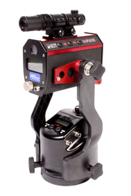 |
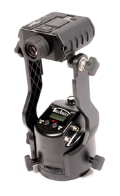
測量三脚取付例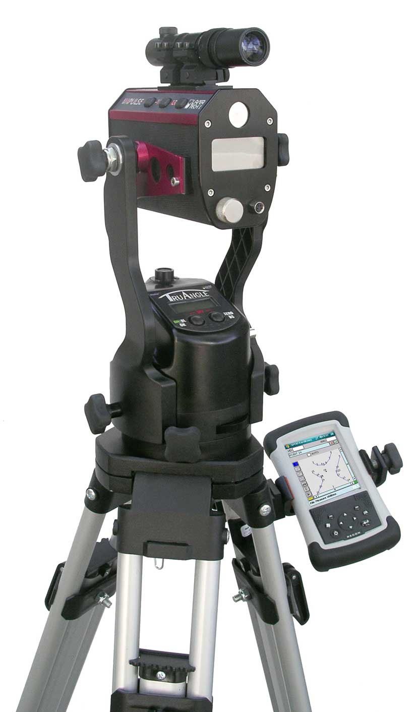 |
|
MapStar TruAngle
|
|
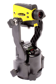  |
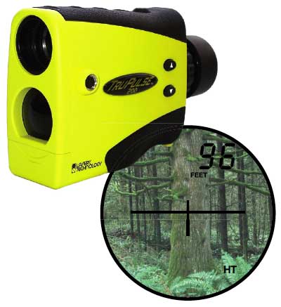
TruPulse200(傾斜計内蔵)
TruPulse360(傾斜計、方位計内蔵)
pdfパンフレットはこちらからパスワードを入手 してダウンロードできます。(無料)
ご 注文方法(個人、法人、公費購入)・送料・代引手数料について
|
MapStar TruAngle |
|
|
販売価格 |
¥310,000- |
|
方位・水平角 |
水平角 0〜359.99° |
|
同上精度 |
+/- 0.05° |
|
同上分解能 |
0.01° |
|
動作温度範囲 |
|
|
電源 |
単二アルカリ乾電池2本使用7時間 |
|
インターフェイス |
|
|
防水 |
|
|
寸法 |
14.2 x 11.7 x 11.7 cm
|
|
重量 |
1.0kg |
Download Message Format
The compass downloads data messages in this form:
$PLTIT,HV, HD, HDunits, AZ, AZunits,INC, INCunits, SD, SDunits
*csum<CR><LF>
where:
$PLTIT:is the Criterion 400 format message identifier.
HV: identifies a the Criterion 400 horizontal vector data line.
HD: specifies a horizontal distance measurement value.
HDunits:specifies horizontal distance units: F = feet M = meters
AZ: specifies an azimuth measurement value.
AZunits:specifies azimuth units:D = degrees G = grads
INC: specifies an inclination measurement value.
INCunits: specifies inclination units: D = degrees G = grads
SD: specifies a slope distance measurement value.
SDunits:specifies slope distance units:F = feet M = meters
*csum consists of an asterisk followed by a two-digit hexadecimal
Response/download using Stand Alone or Only mode:
$PLTIT,HV, , ,124.8,D, , , , *02
Response/download using the compass in Append mode:
$PLTIT,HV,22.58,F,124.8,D,34.79,D,27.51,F*6D
・ ・ ・ ・
HD AZ INC SD
$PLTIT,HV, , ,124.8,D, , ,27.51,F*6B
・ ・
AZ SD
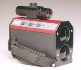
 コンパス付 レーザー距離計 |
||||||
レーザー距離計用途 トップへ
用途
備考
1. 建築 概算見積用の簡易計測に、安全距離計測に 2. 土木 概算見積用の簡易計測に 3. 不動産 概算見積用の簡易計測に 4. 港湾業務に 岸壁からの距離把握に 5. 電気工事 電線の長さ、電柱間の距離 6. その他 GISデータ収集、GPSオフセット測量
E-Mail -
 Impulseシリーズ距離計はこちら